Student flies in Study of Air-Sea Fluxes and Atmospheric River Intensity (SAFARI) campaign, shares importance of satellite imagery
By Jared Stickney | March 2026
Ninety percent of the transport of atmospheric moisture from the tropics to the poles is due to atmospheric rivers.
Sierra Whiteman, a master’s student at CSU’s Department of Atmospheric Science in Professor Steven Miller’s group, works on a multi-scale study of atmospheric rivers to determine the factors that contribute to their origin, structure, size and intensity globally. Whiteman investigates what controls the intensity of atmospheric rivers, and how to better forecast them by understanding their sources.
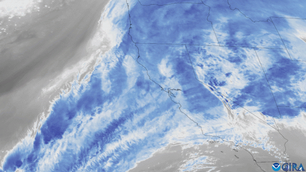
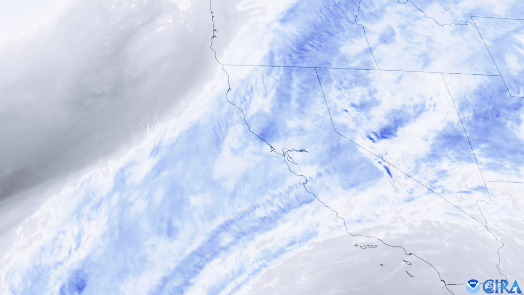
Atmospheric rivers are akin to the rivers we see every day, in the sense that they serve as a mode of moisture transport from one region to another. The key difference with atmospheric rivers is that they occur in the sky. Whiteman explains that atmospheric rivers are “really big, like a regular river. They’re sometimes over 10,000 km long…[and] look like long, thin filaments of water vapor,” when viewed with satellite imagery.
Atmospheric rivers play a critical role in providing vast reservoirs of moisture for wintertime storms. Without them, the midlatitudes would be much drier. Whiteman points out that some regions of the Earth, like the U.S. West Coast, rely on atmospheric rivers for up to 50% of their annual precipitation. While atmospheric rivers are responsible for crucial precipitation globally, their intensities can be vastly different. A particularly intense atmospheric river caused the catastrophic flooding that took place in California during December 2022 – January 2023. A large community of researchers are dedicated to studying and predicting these deluges, as they affect operational decisions for major reservoirs in the western US, and also affect the Colorado western slope snowpack.
Student Experience
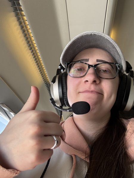
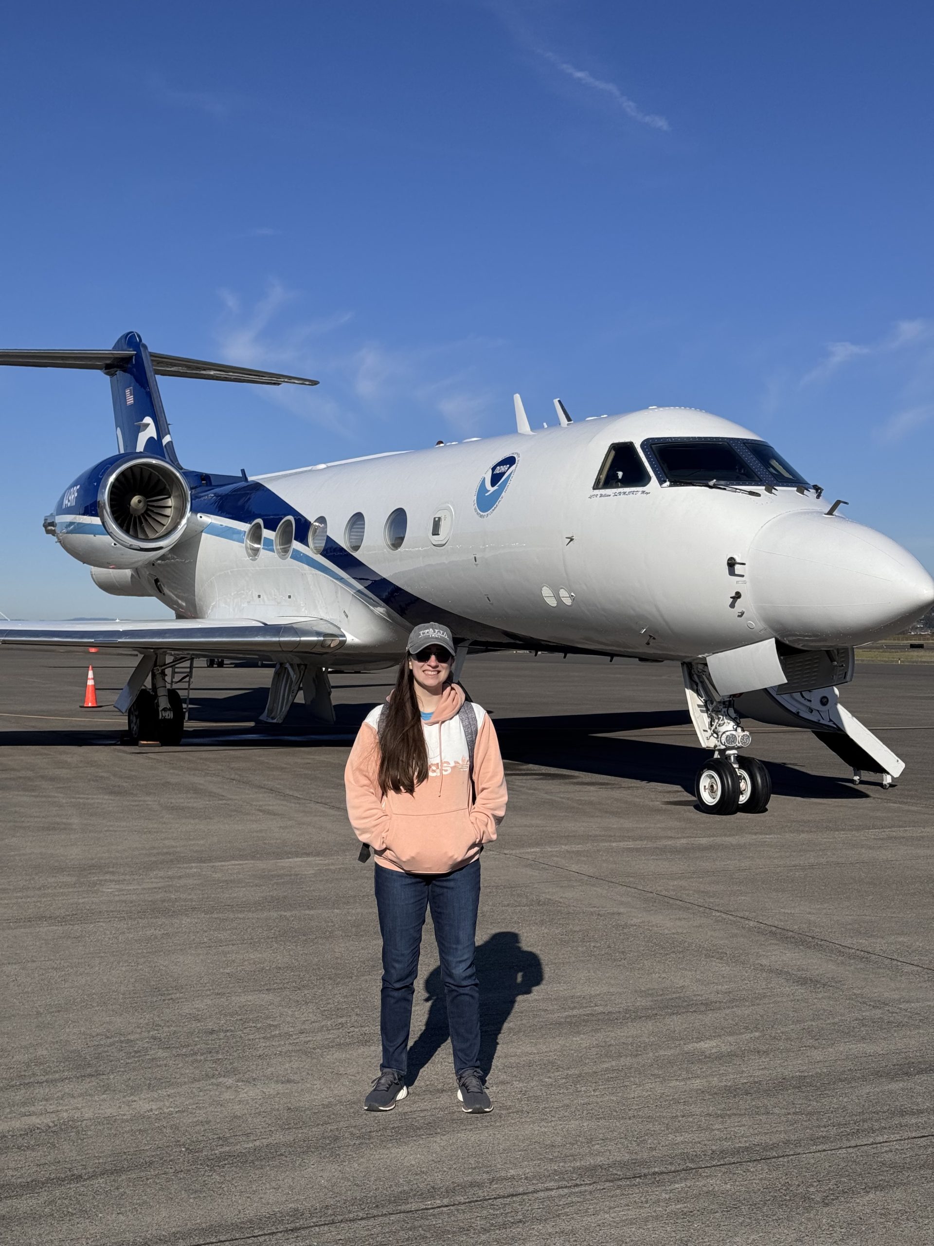
Whiteman has combined her research in atmospheric rivers with her love of working with remote sensing data. In 2023, Whiteman was part of the NASA Student Airborne Research Program, and got to fly on a plane taking atmospheric measurements, which sparked her passion for airborne research in atmospheric science. Her interest led to an exciting experience during February 2026 in Portland, Oregon, where Whiteman had the opportunity to fly on NOAA’s G-IV aircraft for the Study of Air-Sea Fluxes and Atmospheric River Intensity (SAFARI) campaign, part of a larger Atmospheric River Reconnaissance (ARRecon) program headed by the Scripps Institute of Oceanography (SIO) at the University of California at San Diego (UCSD).
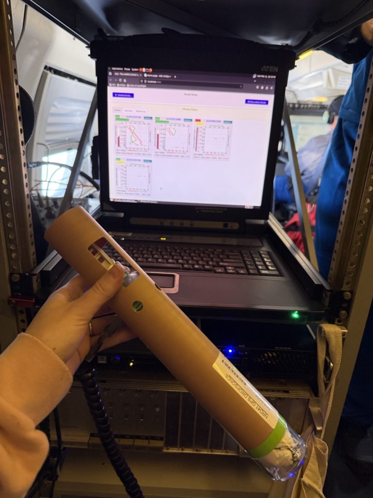
On the G-IV, Whiteman launched two dropsondes – instruments that fall from high in the atmosphere to the ground – measuring pressure, temperature, humidity, wind speed, and wind direction in the atmospheric column. Whiteman is now working on providing satellite data post-flight to investigate total precipitable water, which is the depth of water in the atmospheric column if all of it were to condense and precipitate as rain. Whiteman is comparing observed total precipitable water from satellites when the dropsondes were launched to the measured dropsonde data.
One might assume that most atmospheric rivers occur in the tropics and midlatitudes, where water vapor is abundant, but Whiteman indicates this may not always be the case. Rather, she says she has found them as far poleward as Alaska and Antarctica, as well as “siphoning off moisture from tropical cyclones.” The identification process involves utilizing satellite imagery of total precipitable water. Additionally, Whiteman uses ERA-5 reanalysis data to compare against the satellite imagery that she analyzes. Identification of atmospheric rivers is extremely complex, but Whiteman adds that coding scripts from scientists who have studied atmospheric rivers for decades helps. Once these various source regions are identified, Whiteman then identifies the size, duration, and intensity of each atmospheric river in order to find any correlations that may explain their behavior for better future prediction.
Whiteman also expresses how essential satellite data and the Cooperative Institute for Research in the Atmosphere (CIRA) is for atmospheric science research, including her own work. Both topography and vast oceans make predicting large-scale weather phenomena, such as atmospheric rivers, extremely difficult to do if one cannot see the state of the entire atmosphere at high time resolutions, something that is only possible with satellites.
“Satellites are our critical eyes-in-the sky on these massive moisture transport events.” Prof. Steven Miller, Director of CIRA, notes, “With these unique measurements, we can trace an atmospheric river from its headwaters to its landfall, and what’s more, understand the atmospheric ‘topography’ of the path it follows–helping us to better understand and predict the behavior and downstream impacts.”
“Satellites give you lots of important information, sometimes minute-by-minute, which makes an important and valuable change for forecasting,” added Whiteman.
Additionally, Whiteman highlights the importance of CIRA and other cooperative institutes (16 competitively selected NOAA partnerships with Universities across the country) for supporting students and the broader research community.
“Not even just for students, but [anyone] being able to talk to all of these experts with so much knowledge in many research topics, and to have all this great research happen in one place… CIRA is such an amazing resource.”
Whiteman’s incorporation of satellite data, knowledge from cooperative institutes, and passion for better understanding the atmosphere exemplifies how collaboration amongst scientists can help change the world. Whiteman says the better that we can predict atmospheric rivers, the more prepared the public will be, which will ultimately end up saving lives.